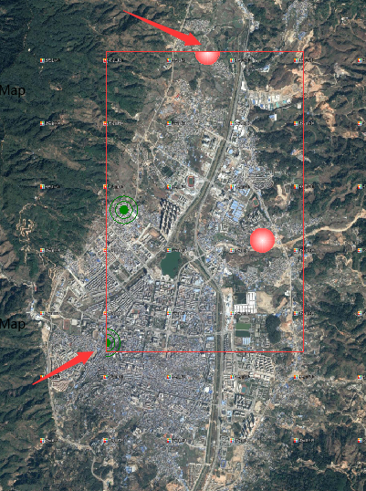
我加载了两个图层,点的样式被截断了,如下图,图上不部分圆剩一半,右下角剩1/4
我的代码:
//创建地图控件
    function init() {
      map = new SuperMap.Map("map", {
        controls: [
          new SuperMap.Control.ScaleLine(),
          new SuperMap.Control.Zoom(),
          new SuperMap.Control.LayerSwitcher(),
          new SuperMap.Control.Navigation({ //添加导航控件到map
            dragPanOptions: {
              enableKinetic: true //拖拽动画
            }
          })
        ],
        allOverlays: true
      });
      //初始化复杂缩放控件类
      panzoombar = new SuperMap.Control.PanZoomBar();
      // 是否固定缩放级别为[0,16]之间的整数,默认为false
      panzoombar.forceFixedZoomLevel = true;
      //是否显示滑动条,默认值为false
      panzoombar.showSlider = true;
      /*点击箭头移动地图时,所移动的距离占总距离(上下移动的总距离为高度,左右移动的总距离为宽度)
      的百分比,默认为null。 例如:如果slideRatio 设为0.5, 则垂直上移地图半个地图高度.*/
      panzoombar.slideRatio = 0.5;
      //设置缩放条滑块的高度,默认为120
      panzoombar.sliderBarHeight = 180;
      //设置缩放条滑块的宽度,默认为13
      panzoombar.sliderBarWidth = 17;
      map.addControl(panzoombar);


      //创建分块动态REST图层,该图层显示iserver 8C 服务发布的地图,
      //其中"world"为图层名称,url图层的服务地址,{transparent: true}设置到url的可选参数
      layer = new SuperMap.Layer.TiledDynamicRESTLayer("地图", url[1],
        {cacheEnabled: true}, {
          maxResolution: "auto"
        });
      layer.events.on({
        "layerInitialized": addLayer
      });


    }

    var inited = false;

    function addLayerImage() {
      map.addLayer(layerImage);
    }

    function addLayer() {
      //将Layer图层加载到Map对象上
      map.addLayer(layer);

      layerImage = new SuperMap.Layer.TiledDynamicRESTLayer("监测点", url[3],
        {transparent: true, cacheEnabled: true}, {
          maxResolution: "auto",
          maxExtend:new SuperMap.Bounds(-180,-90,180,90)
        });
      layerImage.events.on({
        "layerInitialized": addLayerImage
      });

      //出图,map.setCenter函数显示地图
      try {
        var lonLat1 = new SuperMap.LonLat(100.08831, 23.88535);
        console.log("lonLat1", lonLat1);
        //这里 lonLat1 = lonLat2
        var lonLat2 = lonLat1.transform(
          new SuperMap.Projection("EPSG:4326"),
          new SuperMap.Projection("EPSG:3857")
        );
        console.log("lonLat2", lonLat2);
        map.setCenter(lonLat2, 2);
        //map.panTo(new SuperMap.LonLat(100.104623,23.887861));
      } catch (ex) {
        console.log(ex);
      }
    }


