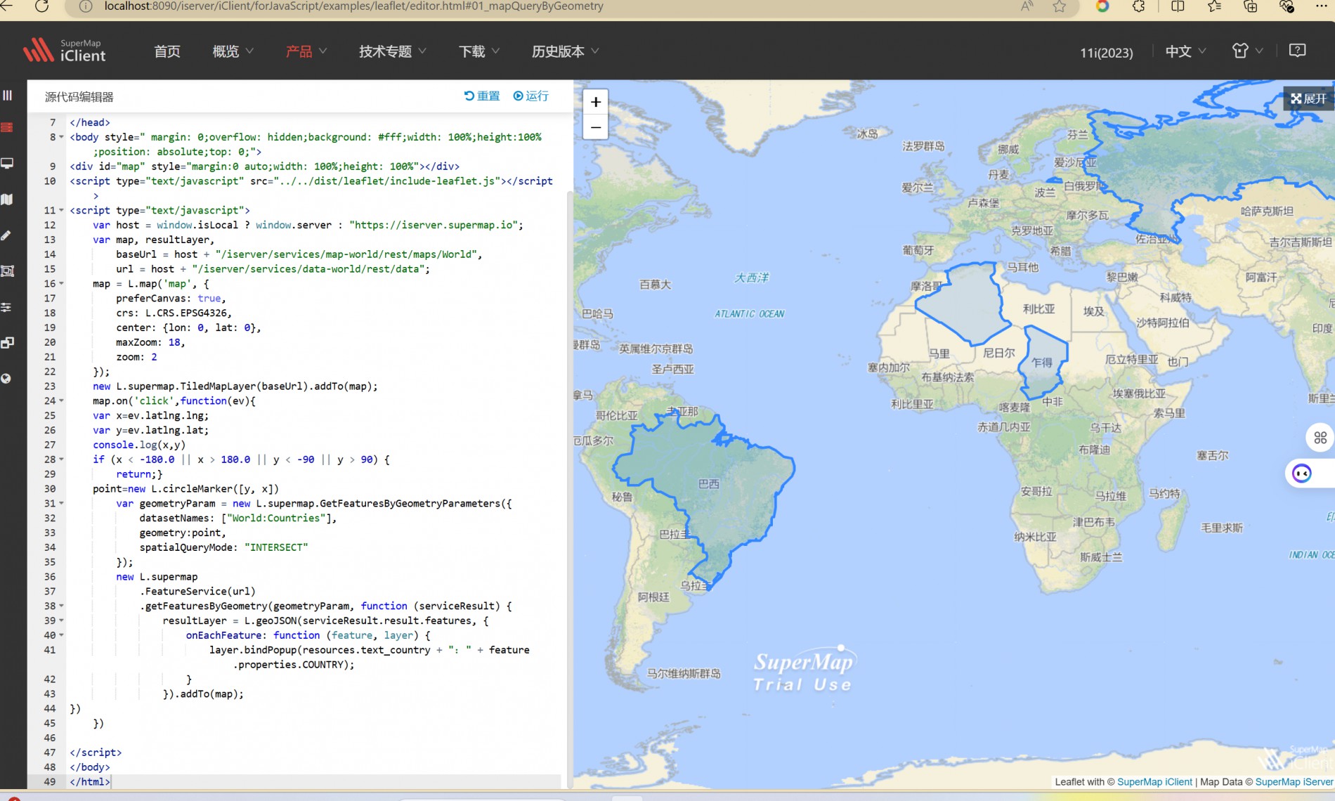
使用产品:iserver11.1.1a,操作系统win11 x64 文件型及数据型 我想知道iserver的查询服务是否对数据具有一定的要求,因为我同时尝试了运用了iserver的地图查询方式queryservice以及数据查询的featureservice服务都没能出现我想要的查询结果,但是在控制台并没有报错,具体如下:

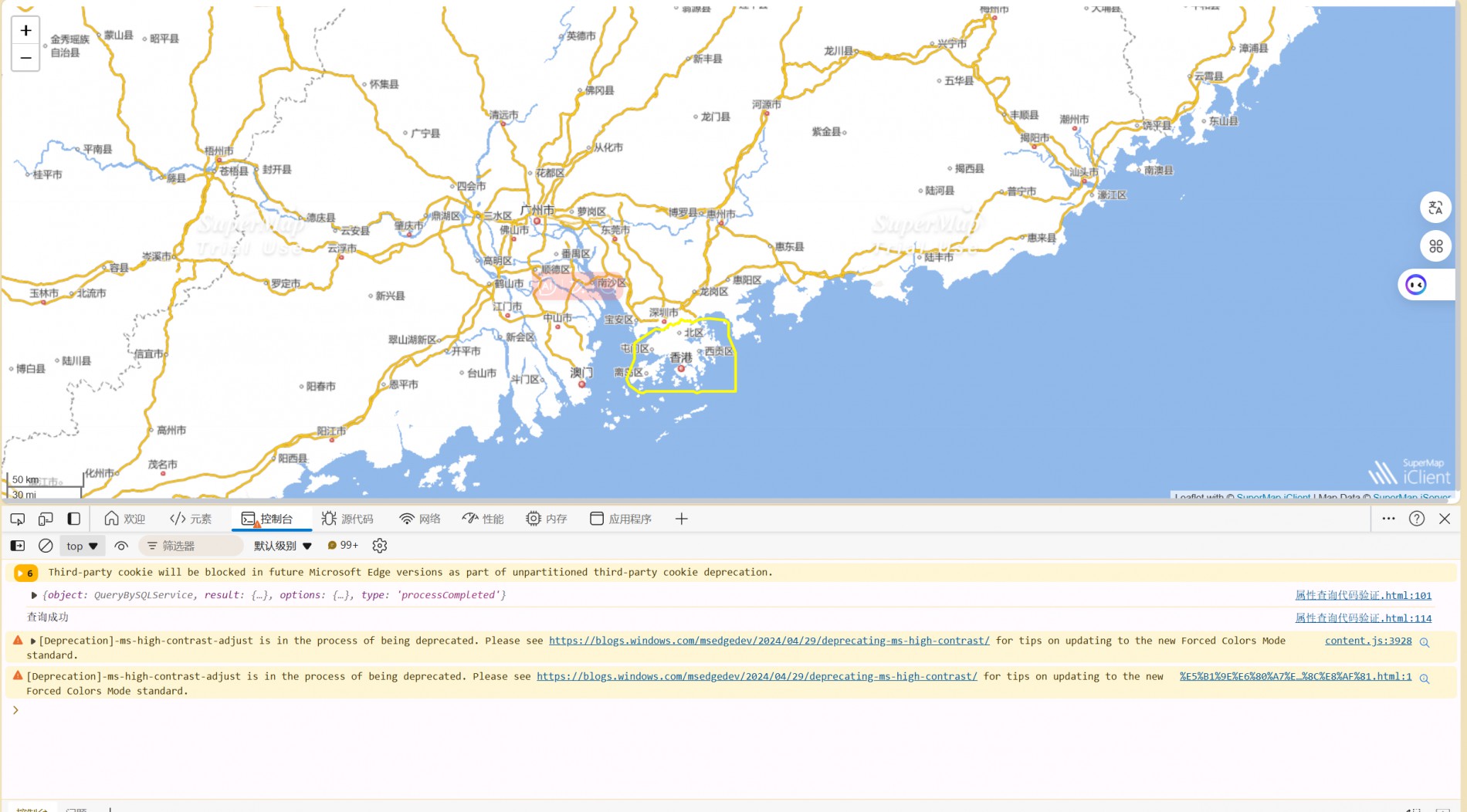
首先我运用数据服务的几何查询服务进行查询,示例代码如上: 可以看到代码是完全正确的,但是我替换为自己的图层之后却并没有出现点击选中的功能,于是我换一种思路尝试使用queryservice来进行查询服务,代码运行结果如下:

源代码如下:
    var host = window.isLocal ? window.server : "https://iserver.supermap.io";
    var map,marker,featureGroup, resultLayer,featureService
    var url = "http://localhost:8090/iserver/services/map-china400/rest/maps/China_4326?prjCoordSys=%7B%22epsgCode%22:3857%7D";
    var url2 = "http://localhost:8090/iserver/services/data-China400/rest/data";

    var map = L.map('map', {
        crs: L.CRS.EPSG3857,
        center: [34.549251227880845,108.77560066236568],
        maxZoom: 18,
        zoom: 7
    });
new L.supermap.TiledMapLayer(url).addTo(map)
      map.on("click", function (evt) {
        var x = evt.latlng.lng;
        var y = evt.latlng.lat;
        if (x < -180.0 || x > 180.0 || y < -90 || y > 90) {
            return;
        }
        point = new L.circleMarker([y, x]);

        var geometryParam = new L.supermap.QueryByGeometryParameters({
            datasetNames: ["China_Xianggang_ln@China"],
            geometry:point,
        });
        spatialQueryMode: "INTERSECT"
        console.log(geometryParam)
        new L.supermap
            .QueryService(url)
            .queryByGeometry(geometryParam, function (serviceResult) {
                console.log(serviceResult.result)
                 if(resultLayer!=undefined){
                  resultLayer.remove();
                  console.log(resultLayer)
                };
            });
    });


    new L.supermap.TiledMapLayer(url).addTo(map);
    L.control.scale().addTo(map);

    var param=new L.supermap.QueryBySQLParameters({
        queryParams: {
            name: "China_Xianggang_ln@China",
            attributeFilter: "SMID>0"
        },
        datasetNames: ['China:China_Xianggang_ln']
    });

    new L.supermap.QueryService(url).queryBySQL(param,function(result){
        console.log(result)
        var result = result.result;
        resultLayer = L.geoJSON(result.recordsets[0].features,{
                style:function (geoJsonFeature) {
                         return{
                            color:'yellow',
                            stroke:true,
                            weight:3
                         }
            }
            }).addTo(map);
        // doSomething
        if(resultLayer){
                console.log("查询成功")
            }
    });
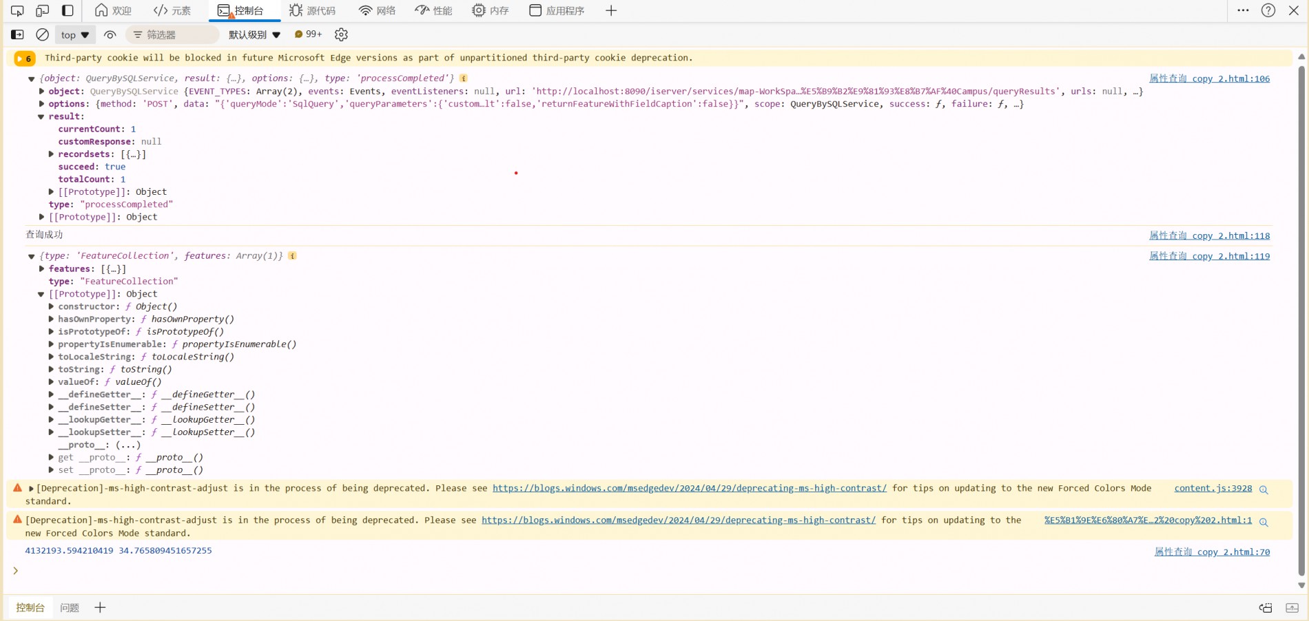
接下来是我同时使用queryservice及featureservice运用在我的图层上的运行结果及代码:

         var map = L.map('map', {
            crs:L.CRS.EPSG3857,
            center:[34.765589, 4132193.592603],
            maxZoom: 20,
             zoom: 17
         });
        // 加载地图
        new L.supermap.TiledMapLayer(url).addTo(map);
        L.control.scale().addTo(map)
map.on('click',function(ev){
    var x=ev.latlng.lng;
    var y=ev.latlng.lat;
    console.log(x,y)
    if (x < -180.0 || x > 180.0 || y < -90 || y > 90) {
        return;}
    point=new L.circleMarker([y, x])
    var geometryParam=L.supermap.GetFeaturesByGeometryParameters({
            geometry:point,
            datasetNames:['Campus:建筑'],
            spatialQueryMode:"INTERSECT"
        })
        if(geometryParam){
            console.log('finish')
        }else{console.log('fail')}
        console.log(geometryParam)
        new L.supermap
            .FeatureService(url2)
            .getFeaturesByGeometry(geometryParam, function (serviceResult) {
                console.log(serviceResult)
                resultLayer = L.geoJSON(serviceResult.result.features, {
                    onEachFeature: function (feature, layer){

                    }
                }).addTo(map);
})
})


        var param=new L.supermap.QueryBySQLParameters({
            queryParams:{
                name:"建筑@Campus",
                attributeFilter: "名称 like '%办公楼%'"
            },
            datasetNames: ['Campus:建筑']
        }
        )
        new L.supermap.QueryService(url).queryBySQL(param,function(result){
            console.log(result)
            var myIcon=L.icon({iconUrl:'image/myicon.png',iconsize:40})
            var result = result.result;
            resultLayer = L.geoJSON(result.recordsets[0].features,{
                style:function (geoJsonFeature) {
                         return{ color:'red',
                            stroke:true,
                            weight:10}
            },
        }).addTo(map);
            if(resultLayer){
                console.log("查询成功")
                console.log(result.recordsets[0].features);
                map.addLayer(resultLayer)
            }else{console.log("Failed to add layer to the map")}
        })
可以看到我几乎为每一步都设置了打印但是每次运行到相关service服务时都被终止了而没有出现相应的打印内容,甚至没有报错,这让我感到无从下手

 热门文章
热门文章


