产品:iServer 11.1.1
在iServer上发布地图和交通分析服务后。编写最佳路径分析方法的代码,执行后出错,console.log提示错误信息:"执行 findPath 操作时出错,原因是:findPath\n对象已经被释放 "
var mymap;
var urlMY="http://192.168.74.16:8090/iserver/services/map-Malaysia_retail/rest/maps/Country_R%40malaysia_source";
    urlMYNight="http://192.168.74.16:8090/iserver/services/map-Malaysia_retail/rest/maps/Country_R%40malaysia_source1";
    urlservice ="http://192.168.74.16:8090/iserver/services/transportationAnalyst-Malaysia_retail/rest/networkanalyst/RoadNet@Kuala_Lumpur_source";

var supermarketPoints = [];
var resultLayer;
var findPathService, findPathParameters;
var trackLocationLayer = [];
var geoLocationID;

function loadLeafletMap(){
    var MY = new L.supermap.tiledMapLayer(urlMY,{noWrap:true});
    var MYNight = new L.supermap.tiledMapLayer(urlMYNight,{noWrap:true});
    mymap = L.map('mapid', {
        layers: MY,
        crs: L.CRS.EPSG3857
    }).setView([3.140300, 101.688015],12);
    var baseMaps = {"Malaysia": MY, "MalaysiaDark": MYNight};
    L.control.layers(baseMaps).addTo(mymap);
}

function querySupermarket(){
    console.log("start querying");
    var param = new L.supermap.QueryBySQLParameters({
        queryParams: new L.supermap.FilterParameter({
            name: "pois@Kuala_Lumpur_source",
            attributeFilter: "fclass = 'supermarket'"
        })
    });
    // console.log("param:");
    // console.log(param);
    L.supermap.queryService(urlMY).queryBySQL(param, function(serviceResult){
        // console.log("result1:");
        // console.log(serviceResult.result);
        var result = serviceResult.result;

        var supermarketIcon = L.icon({
            iconUrl:'images/supermarketIcon.png',
            iconSize:[30]
        });

        resultLayer = L.featureGroup().addTo(mymap);
        // console.log(resultLayer);
        for(var i = 0; i < result.recordsets[0].features.features.length; i++){
            var p = result.recordsets[0].features.features[i];
            var latlng = L.point(p.geometry.coordinates[0],p.geometry.coordinates[1]);
            supermarketPoints.push(latlng);
            var marker1 = L.marker(L.CRS.EPSG3857.unproject(latlng), {icon:supermarketIcon})
                .bindPopup('Supermarket Name: ' + p.properties.name)
            resultLayer.addLayer(marker1);
        };

        console.log("loaded complete");
    })
}

function SupermarketPath(){
    // 获取网络分析的地址
    findPathService = new L.supermap.NetworkAnalystService(urlservice);
    // 创建最佳路径分析参数实例
    var resultSetting = new L.supermap.TransportationAnalystResultSetting({
        returnEdgeFeatures: true,
        returnEdgeGeometry: true,
        returnEdgeIDs: true,
        returnNodeFeatures: true,
        returnNodeGeometry: true,
        returnNodeIDs: true,
        returnPathGuides: true,
        returnRoutes: true
    });
    console.log('supermarketPoints');
    console.log(supermarketPoints);

    var analystParameter = new L.supermap.TransportationAnalystParameter({
        resultSetting: resultSetting, //分析结果返回显示内容
        weightFieldName: "SmLength" //阻力字段
    });
    findPathParameters = new L.supermap.FindPathParameters({
        isAnalyzeById: false,
        nodes: [supermarketPoints[0], supermarketPoints[1]],
        parameter: analystParameter
    });
    var myIcon = L.icon({
        iconUrl: "images/walk.png",
        iconSize: [20,20]
    });
    //进行路径查找
    findPathService.findPath(findPathParameters, function (serviceResult){
        var result = serviceResult.result;
        console.log('findPathService result:');
        console.log(serviceResult);
        result.pathList.map(function (result){
            L.geoJSON(result.route).addTo(mymap);
            L.geoJSON(result.pathGuideItems,{
                pointToLayer: function (geoPoints, latlng) {
                    L.marker(latlng, {icon: myIcon}).addTo(mymap);
                },filter:function (geoJsonFeature){
                    if(geoJsonFeature.geometry && geoJsonFeature.geometry.type === 'Point'){
                        return true;
                    }
                    return false;
                }
            }).addTo(mymap);
        })
    });
    console.log('findPathService');
    console.log(findPathService);
}
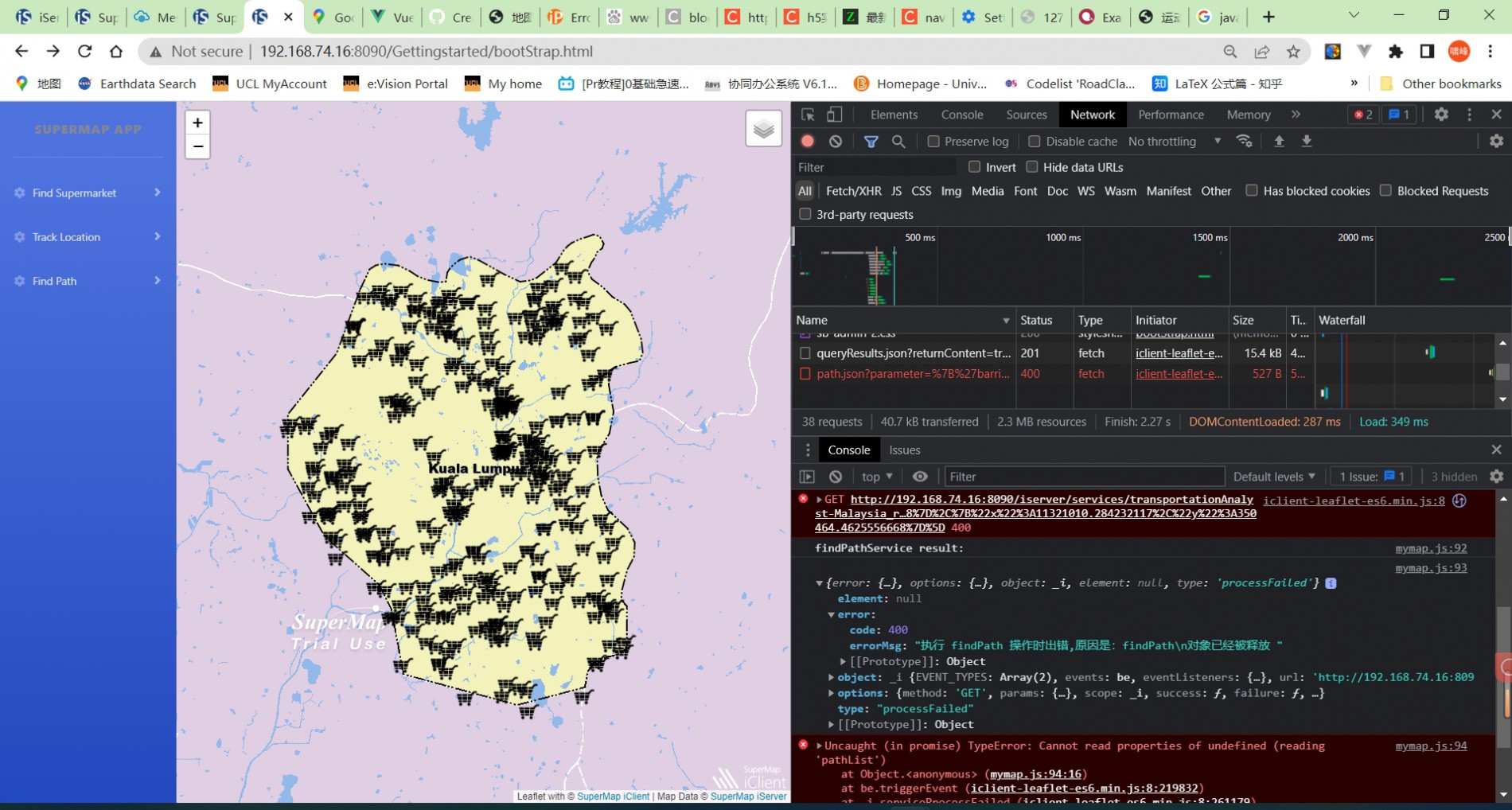
请问该错误是什么原因?该如何查找错误?


